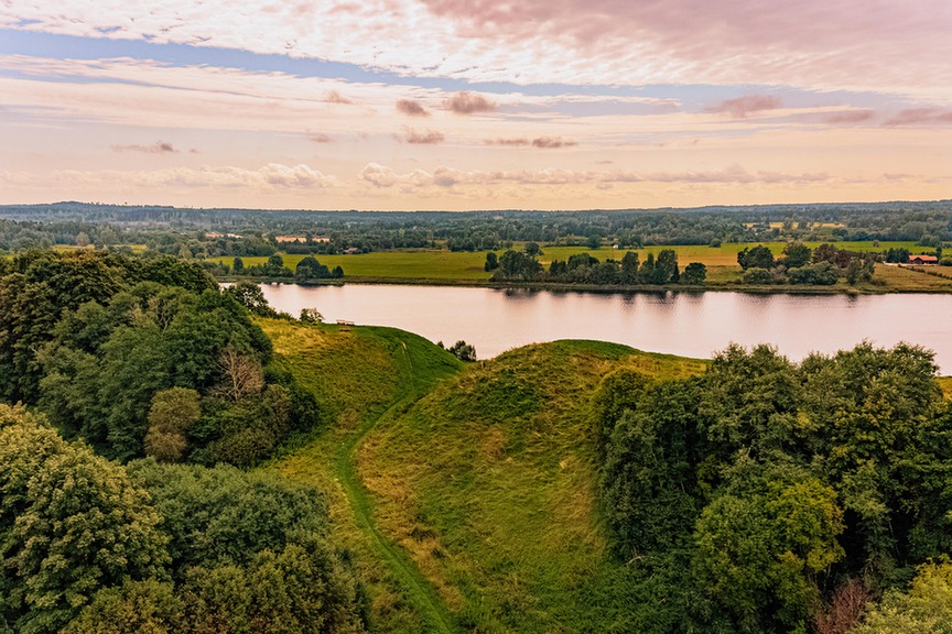
Aizkraukle Castle Mound – Augstie or Kraukļu Hills
Skrīveri, Skrīveru pagasts, Aizkraukles novads, Latvija, LV-5125Aizkraukle Castle Mound is located on the right bank of the Daugava River, approximately 82 km from Riga. It is one of the most significant archaeological and cultural-historical sites in Latvia, rising almost 40 meters above the Daugava River and ~67 meters above sea level. The length of the castle mound is about 100 meters, and the width is from 45 to 65 meters.
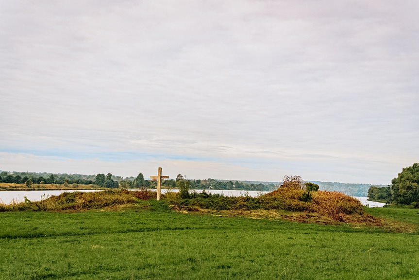
The castle mound is bordered from the northwest by the Ašķere River, while on the other side the Kraukļupīte River flows, which together form a natural defense. It has been mentioned several times in written sources as early as the 13th century, including the Chronicle of Henry, which also mentions the castle ruler Vievaldis (Viewaldus). It is known that in 1205 the Crusaders burned down a wooden castle in this place.
Archaeological research indicates the existence of an ancient settlement - both Livonians and Latgalians lived at the foot of the castle mound. Excavations have revealed more than 30 buildings, 98 ovens, a potter's kiln and an iron-making furnace. The oldest evidence found dates back to the 1st millennium BC.
Nowadays, a parking lot has been set up near the hillfort, and at the top there is a recreation area with benches and a beautiful view of the Daugava valley. It is a great place to simultaneously feel the presence of history and enjoy the natural landscape of Latvia.


 This virtual toure has been produced as part of the project LL-00061 "Digitally accessible and attractive Lost Culture Heritage tourism destinations in Zemgale and Northern Lithuania" (Reclaimed History), which is co-funded by the European Union under the Interreg VI-A Latvia-Lithuania Programme 2021-2027. Its contents are the sole responsibility of Aizkraukle local municipality and do not necessarily reflect the views of the European Union.


- Aizkraukle municipality and Koknese Tourism Information centre
1905. gada iela 7, Koknese
(+371) 29275412, (+371) 65161296 - Aizkraukle Tourism Information point
Lāčplēša iela 4, Aizkraukle
(+371) 25727419 - Jaunjelgava Tourism Information point
Jelgavas iela 33, Jaunjelgava
(+371) 27366222 - Pļavinas Tourism Information point
Daugavas iela 49, Pļaviņas
(+371) 22000981 - Skrīveri Tourism Information Point
Daugavas iela 85, Skrīveri, Skrīveru pagasts
(+371) 25661983 - Staburags Tourism Information point
Staburaga saieta nams, 2. stāvs, Staburags, Staburaga pagasts
(+371) 29892925 - Nereta Tourism Information point
Dzirnavu iela 5, Nereta, Neretas pagasts
(+371) 26674300 - Mazzalve Tourism Information point
Skolas iela 1, Ērberģe, Mazzalves pagasts
(+371) 26156535 - Irši Manor Barn - Magazina
Irši, Iršu pagasts
(+371) 29275412
